
▸ Traffic Data Analytics
Smarter Traffic Insights for Faster, Safer Mobility
Turning raw traffic data into actionable insights that help cities, businesses, and planners optimize flow, reduce congestion, and make smarter mobility decisions in real time.
Three stages. One readable output.
Sensor ingestion
Real-time data processing
Decision-ready dashboard
We connect to the detection hardware already in your network — loop detectors, radar units, video sensors. No rip-and-replace. Integration is planned around what's already deployed.
Vehicle counts, speed, and flow direction are normalized and validated continuously. The system flags anomalies and gaps before they reach your operators — bad data stays out of the dashboard.
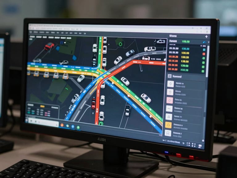
The interface is built for control-room staff, not data analysts. Bottleneck location, signal timing deviation, and volume thresholds are surfaced in plain, actionable language.
Built for the person at the control box.
Every view is designed around a single question: what does this operator need to do right now? Congestion threshold breaches, signal timing drift, and sensor drop-outs surface as clear alerts — not buried in data tables.
The dashboard ships with a layout your team can support in six months without needing the original implementation team on call.
See your network in real time.
Request a scoping call and we'll walk your team through a live session using your intersection data — or a representative municipal dataset if you're still in evaluation.